

RASHT (Rašt), city and district in the providence of Gilān.
i. The City
Located at lat 37°17′ N, long 49°35′ E, with an average elevation of 5 m, Rasht is the capital of Gilān and the largest city along the Caspian coast of Iran.
Nestled between the Zarjub and Gowhar-rud rivers, Rasht is distinctive in appearance from cities of the Iranian plateau. The old city is not surrounded by gated walls, and the bazaar is open, not covered. Such distinctive features, characteristic of urban settlements in Caspian Iran, have been noted by various historical travelers and emissaries. In 1772 Johann Friedrich Gmelin wrote that Rasht “has no gate or wall and owes its city name to the general trade in which it has continually engaged since early times” (Rabino, p. 69). Elsewhere, H. L. Rabino, the early twentieth-century English vice-consul in Rasht, described the bazaar in these words: “Instead of a vaulted roof or dome stretching from one end of the street to the other, there are canopies on both sides to protect from the sun and rain” (Rabino, p. 72). Until the 20th century, Rasht remained only lightly populated; according to the more optimistic official and traveler estimates its population did not exceed 60,000 until World War I, although this number was reduced greatly following fires or epidemics, such as the 1830-31 plague that killed half the population. According to the 2006 census, the city had 557,366 inhabitants.
History. Rasht began its development very late, during the fourteenth century, when the center of life in the region moved from the mountains to the plains. Up to the seventeenth century, however, the major cities of the area were the dynastic seats Fuman and Lāhijān, respectively the seats of the Eshāqi, who dominated the Biapas (west of the Safidrud), and the Kiā, who dominated Biapiš (to the east). Moreover, Rasht only became the provincial capital of the Gilān under Shah ʿAbbās, when the province was incorporated into the Persian kingdom. Rasht owes its growth and status to its location at the heart of the province, near the sea and at the end of the road from Tehran and Qazvin, and to the development of trade with the West beginning in the seventeenth century. The city, however, has long maintained the appearance of a large rural village. John Bell (pp. 133-35), passing through Rasht in 1717, noted that its “houses were scattered,” that it was located “in a plain surrounded by tall forests,” and that it looked more like “a big village.” The Russians invaded Gilān in 1722 and cleared the forest south of the city near the mountains (Hanway, I, p. 190; Gmelin, cited in Rabino, p. 69), but Rasht retained its rural aspect under the reign of Nāṣer-al-Din Shah, when in 1287/1870 the first map of Rasht was made (accessible in the city hall of Rasht). At the time, manor houses (ḵān) were grouped west and east of the existing central square in the districts of Ustā (Ostād) Sarā, and Ṣayqalān, and wetlands, forests, rice paddies, mulberry plantations, and silkworm nurseries surrounded the town. Rasht’s rural setting did not keep it from becoming a cosmopolitan city even from Safavid times, and under the Qajars its cosmopolitanism grew.
The main reason for the foreign presence in Rasht was the silk trade, which had a historical role in the economy of Gilān. Rabino noted that in the late eighteenth century “there was a large colony of Armenians in Recht [Rasht], as well as a considerable number of Russians, many Hindus and Jews; all maintained separate caravanserais” (Rabino, p. 475). In 1860, seven European trading houses maintained offices in Rasht (Orio, p. 792), and by 1906, there were no fewer than forty representatives of foreign companies who were not only buying silk, but processing cocoons and supplying seeds to farmers (Lafont and Rabino, pp. 143-44; Bromberger, 1989, p. 74). The English, French, Italians, Russians, as well as Greeks from Asia Minor and Armenians ran these establishments.
Russia and Turkey maintained consular services in Rasht, while England and France had vice-consuls. The development of commercial activities led to the establishment of banks: in the early twentieth century, “the Imperial Bank of Persia and the Banque d’escompte de Perse maintain offices” in Rasht (Rabino, p. 80). The city owed its development also to the proximity of the Caspian Sea, a preferred trading route, especially with the development of steam navigation and the opening of the Baku, Tbilisi, and Batum railway at the beginning of the twentieth century. Large volumes of dry cocoons were exported from Rasht via the Caspian Sea to Lyon, Marseilles, and Milan. Rasht was also the principal transfer point for oil, samovars, tea, porcelain, and other goods from Russia (see Bazin and Bromberger, p. 90). These commodities were unloaded in the port of Anzali, carried on the lagoon (mordāb) by small boats to Pir Bāzār, from where they were forwarded overland to Rasht, either by gāri (four-wheel wagon), by pipelines (in the case of oil from Baku), or by a railway between Pir Bāzār and Rasht, which was operated until 1934. From Rasht to the interior of Iran, gāri and camel caravans were the preferred mode of transport. Trade intensified in the late nineteenth century with the construction in 1889 by a Russian company of the Ḡāziān-Rasht-Qazvin road, named Jādda-ye Nikolāy, for the emperor Nicholas (see Bazin and Bromberger, pp. 87-93.)
The exposure of Rasht to international diplomacy and trade contributed to the early development of “European-style” cultural activities, in advance of other Iranian provinces. A theater was founded in the early years of the twentieth century (where Molière’s Tartuffe was played in a Persian version); a national library was opened in 1906; and the community supported some fifty newspapers and magazines (Nowzād, pp. 15-94). Cultural associations flourished, including the Jamʿiyat-e farhang-e Gilān (Gilān Cultural Society), which was founded in 1916 and received a subsidy levied on rice exports in the amount of 5 šāhis per put (16 kg) of rice (Jawdat, p. 21). Another sign of Gilān’s Europeanization and uniqueness was the very early development of women’s associations. During the constitutional revolution female circles (anjomans) were created in the province (Afary, 1989). In the 1930s, Peyk-e saʿādat-e neswān (“The messenger of women’s happiness”), an association of literary women, worked for the advancement of women through various project initiatives and the publication of a bimonthly magazine (Faḵrāʾi, pp. 359-60).
Open-mindedness to new ideas originating in Europe, Russia, and the Caucasus, propensity for the creation of associations, and local sensitivities to foreign domination helped make Rasht an avant-garde city and led to Rasht’s role in the two movements that shook Iran in general and Gilān in particular at the beginning of the twentieth century: the Constitutional Revolution and the Jangali Movement. Early in the century, and especially following the division of Iran in 1907 into two zones of influence, Russian to the north and British to the south, secret or semi-secret societies (anjomans) were created in the city, and linked to social-democratic movements in the Caucasus, where Western liberalism was the topic of debates, along with social progress and the protection of Islam. Among their leaders, radical personalities emerged such as Sayyed Jamāl Šarāšub (“the rebel”) and Raḥim Šišabor (“the glasscutter”), who led revolutionary anjomans and confronted the more conservative landowners’ anjoman. In 1909, the revolutionaries took over Rasht and marched on Tehran, where they joined the Baḵtiāris and contributed to the fall of Moḥammad ʿAli Shah (see Afary, 1991). The Russians countered by occupying northern Iran and Rasht in the fall of 1911.
If the center of the Jangali Movement (1915-21) was Kasmā, Rasht nevertheless played an important role over seven years, the memory of which is celebrated in collective memory (see below). The Jangaliscreated a town hall (baladiya) and a courthouse (adliya), appointed a local governor in January 1918, and effectively controlled the police, the passport office, and other key institutions. The city was taken by the British in July 1918 and by Persian government troops in March 1919. However, following the Bolshevik landing in May 1920, a short-lived Socialist Republic of Persia was founded, with Mirzā Kuček Khan as the president and Rasht as the capital. (Formally, on its newspaper and official letterhead, it called itself hokumat-e jomhuri-ye šowravi-ye Irān “government of the Soviet Republic in Iran” [Gilak, pp. 574, 576].) The “red” coup d’état of 19 July 1920 put an end to the collaboration between communists and Jangalis. Even so, following the ouster of Eḥsānallāh Khan and his replacement by Ḥaydar Khan ʿAmu Oḡli, Mirzā Kuček Khan, who had left Rasht, became head of the government in June 1921. The adventure of Rasht as a capital of socialist Persia ended quickly, however, following the Russo-Persian Treaty of February 1921. Leading his Cossacks, Reza Khan marched on Rasht and occupied the city in November 1921. The General of the Forest (sardār-e jangal) died on 2 December of that year, in the mountains of Ṭāleš, where he had taken refuge.
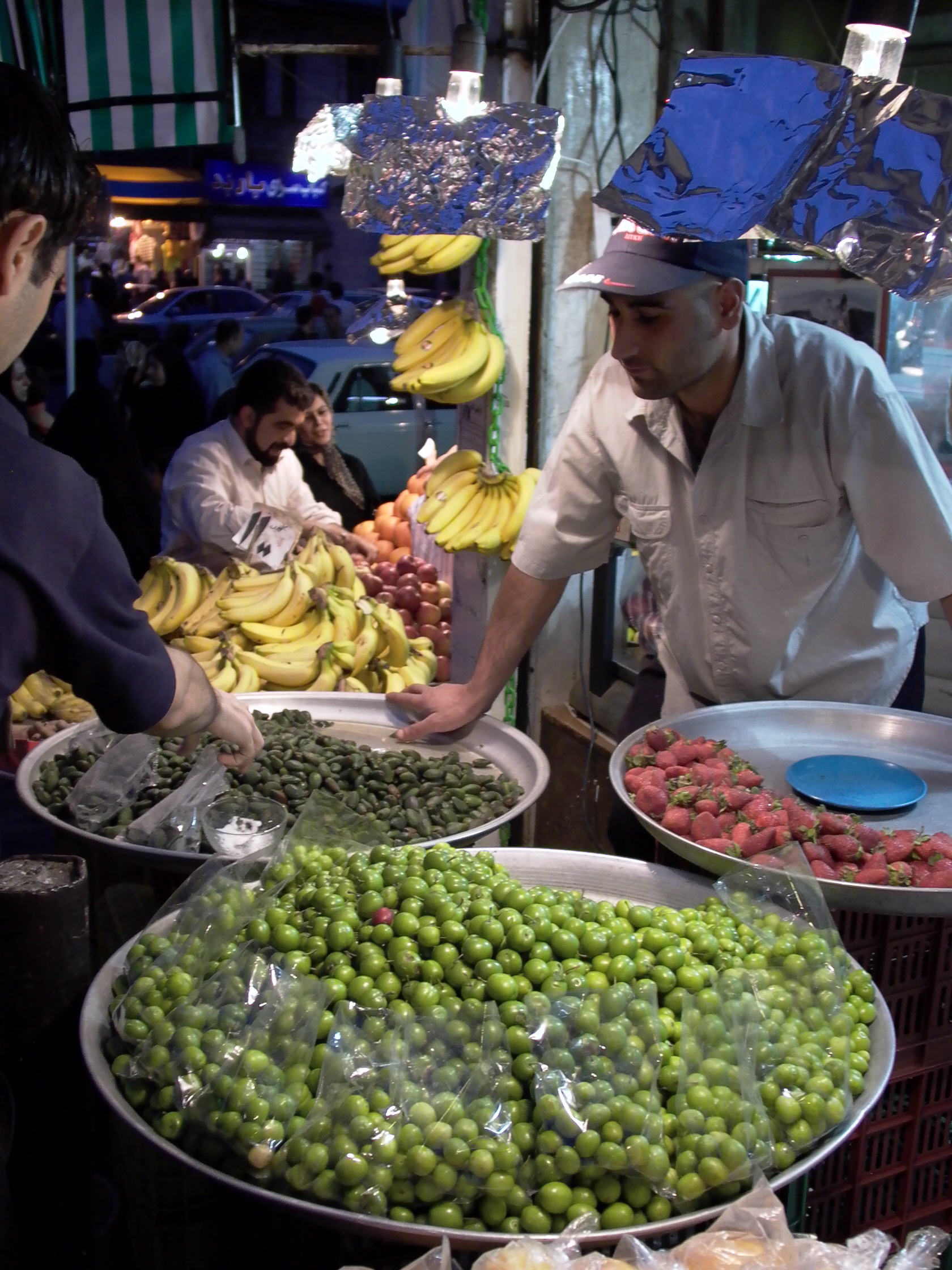
Urban morphology and memory. The historic districts of the city extend from east to west on both sides of the bazaar and Sabza Meydān (Green Square). The southern and northern areas include more recent quarters built over the surrounding countryside. On a map of the city dating from 1953 and established at the request of the then mayor, Mr. Sartip-pur, Saʿdi Avenue, one of the main streets in the northern part of town today, was still surrounded by rice paddies, mulberry plantations (tutestān), and woods (jangal). The southern part of the modern city, below the Gowhar-rud, was not populated then and was only occupied by an airfield, gardens, and fields, a vacant lot (zamin-e bāʾer), etc. From east to west, the old districts were Zāhedān and further south Ḵomeyrān-e Zāhedān, then Ṣayqalān, known for its knife foundries, the bazaar with its specialized sections (clothing, jewelry, pots, stationery, chests, wooden furniture, copper, etc.; Figure 1) and caravanserais (Malek, Moḥtašami, Golšan, Tāqi-e kuček, and Tāqi-e bozorg, among others) surrounded by bār-andāz (unloading platforms) and ḥojra (wholesale offices); to the west of the Town Hall square (šahrdāri) and Sabza Meydān stood the old districts of Bisotun (formerly Kiāb), flanked to the north by Ustā Sarā, and Ḡomār Sarā.
At the beginning of the twentieth century the English consulate was located on Bisotun, while the Russian consulate was south of Ḵomeyrān-e Zāhedān, near Pol-e ʿArāq (ʿArāq “Iraq” is the word used by Gilānis to designate the interior of Iran; see Bromberger, 1988, p. 96) on the road to Tehran. Under Reza Shah large thoroughfares were built from north to south and from east to west, and a post office and city hall were built on the main square. Later, under Mohammed Reza Shah and following the establishment of the Islamic Republic, regional migrations (from rural areas of Gilān and East Azarbaijan) began, leading to a considerable increase in population and expansion of urbanized areas. New neighborhoods were created, producing a markedly different social geography. Since that time, the rich and fashionable neighborhoods include Golsār north of the city, Moṭahhari at the center, and Manẓariya in the south, while middle class residents tend to live in Bisotun, Sabza Meydān, Saʿdi, Ḵomeyrān-e Zāhedān, and Estaḵr. The eastern, southern, and western districts of Kord Maḥalla, Tāza-ābād, Jamārān, and Hāfezābād are mostly home to poor migrants, who settled on the outskirts of the town close to the road leading to their regions of origin. Thus most residents of Jamārān, located south of Rasht, came from Manjil and Rudbār, while most residents of Tāza-ābād, on the eastern outskirts, originate from Āstāna or Lāhijān.
Each old district includes at least one religious building (mosque, emāmzāda, sanctuary). To the east of the bazaar and the current Moṭahhari avenue, there is a large concentration of religious buildings, including boqʿa-ye ḵāhar-e emām “mausoleum of the Imam’s sister” (the fourth sister of Emām Reżā, Fāṭema Oḵrā, who died in Deylamān at the age of 24 while fleeing ʿAbbasid persecution), the mosques of Bādi-allāh and Ṣafi (also known as Masjed-e Safid “White Mosque”), which was built under the Safavids and comprises a Well of the Master of Time (čāh-e sāḥeb-e zamān), and where, on Thursday evenings, the faithful cast messages and offerings to the Hidden Imam. In addition to the Friday Mosque of the bazaar, which dates from the Zand dynasty, the bazaar proper includes mosques for each profession (Masjed-e zargarān, the goldsmiths; Masjed-e Kāsa-forušān, the vessel merchants, which is flanked by a theological school; etc.). To the west of the city lies the shrine of Dānā-ye ʿAli (d. 1256/1840), a mystic who knew the Supreme Name of God (esm-e aʿẓam) and was gifted with ubiquity (ṭayy-al ʿarż) and to whom women pray for miracles. A Bāqerābad Mosque lies to the north of the city, and is named Masjed-e Ḥāj Ṣamad Khan after a rich Šervān merchant whose contributions supported the establishment of the mosque. As elsewhere in Gilān (see GILĀN xvi. FOLKLORE), the living space of a remarkable tree found there is frequently vested with spiritual significance and host to religious devotions. Such was the case of Āq Bibi Zaynāb (“the tree of Zaynāb”) located in the Bisotun quarter, where sterile women would formulate their wishes and tie fabric around the trunk. Following the Islamic Revolution, mausoleums were built on this site and others with similar functions to promote the canon of official piety. As a testament to the city’s cosmopolitan past, Rasht numbers a few Christian churches (Armenian and Protestant); a section of the bazaar called Pošt-e kelisā “Behind the church” indicates the remembered presence of an old church. While there is no synagogue in Rasht, the place name Tappa-ye Yahudi, still in use, gives evidence of Jewish settlement. The most outstanding architecture, however, is found in public, rather than religious, monuments and date from the end of the Qajar and early Pahlavi period. The town hall and the post office are imposing and elegant buildings of early twentieth-century European style, standing on the main city square, while the pavilion ʿEmārat-e Kolāh-farangi adorns the southern city park (Pārk-e šahr, formerly Pārk-e Moḥtašam). In addition, Rasht contains many upper-class houses with brick walls, verandas and wooden doors, wooden mullion and multicolored glass windows, and roofs covered with semi-cylindrical roof tiles, which, according to Rabino (p. 73), were built to resemble the houses of Baku. Interior decorations include ornamental mirrors (āʾinakāri) and plasterwork (gačbori). Among these remarkable houses are the Abrišami house in the Ṣayqalān neighborhood and the Qadiri house in the Sabza Meydān neighborhood. The city offers a number of centenary public baths, such as the bathhouses of Ḥāji Āqā Bozorg (near the Āfaḵrā mosque, southwest of the bazaar), Sāqarisāzān (“tanners”), east of the Bādi-allāh mosque, and Pir-sarā, west of the city in the Bisotun quarter.
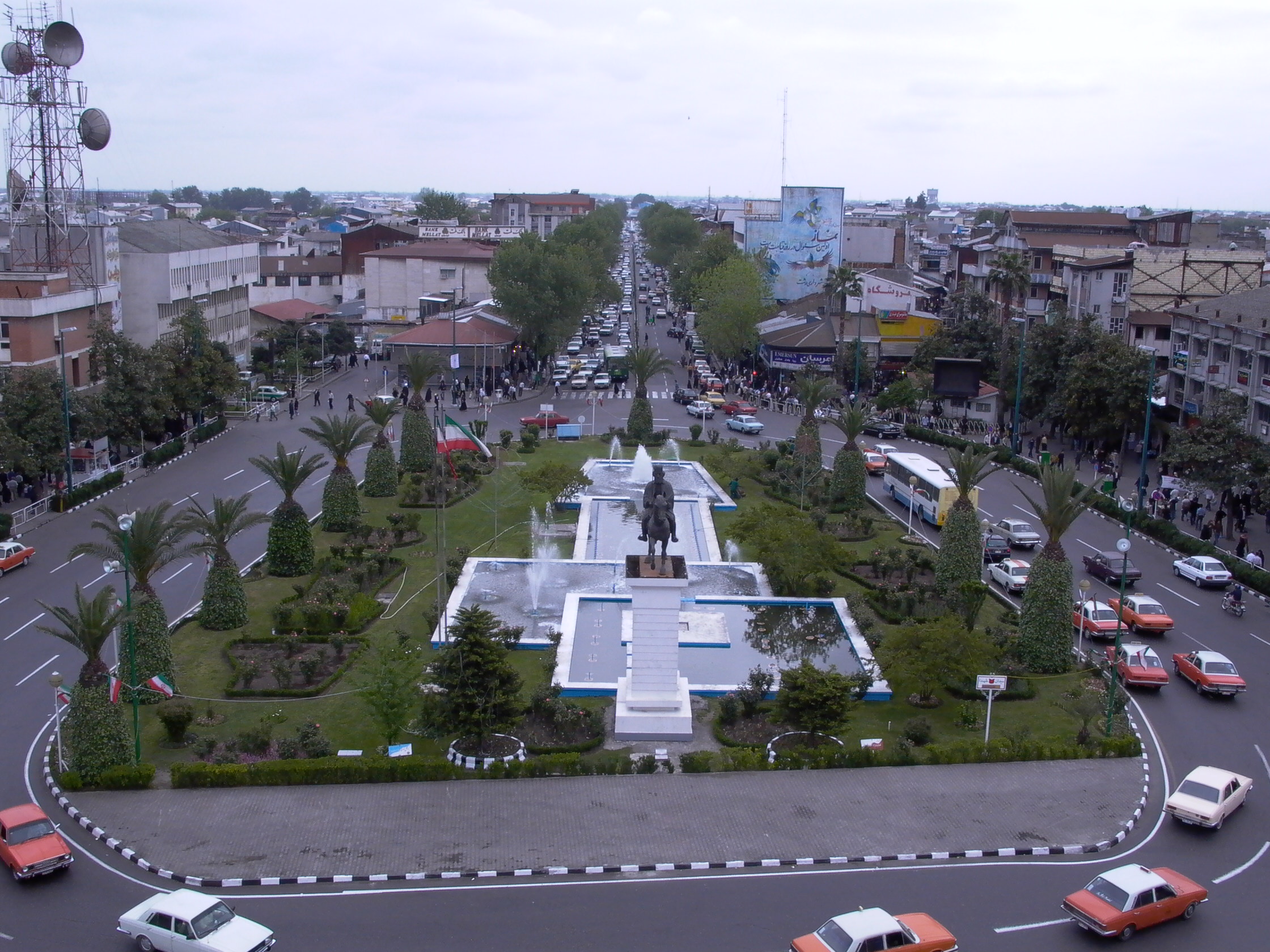
The city also bears traces of the Jangali movement only recently rehabilitated and reclaimed by the Islamic Republic. One of the principle monuments of Rasht is the mausoleum of Mirzā Kuček Khan in Solaymān Dārāb, on the road leading west to Šaft and the forest. Since 2001 an impressive statue of the General of the Forest stands in front of the town hall (Figure 2), at the foot of which the municipal band plays the national anthem everyday. Mirzā’s birthplace, in the district of Ustā Sarā, has been restored and is the headquarters of a foundation devoted to the commemoration of the Jangal, while a statue of Dr. Ḥešmat stands close to his grave on a square of Khomeini Boulevard.
As a result of Rasht’s lifestyle, which is less formal than in the interior of Iran, and its culinary specialties (some of which are named for the city, such as šāmi rašti, meatballs enjoyed during Ramadan), Rasht is now, for the people of the Plateau, the iconic city of the Caspian region, so much so that the noun and adjective “Rashti” are used to describe and define, in a generic way, the people, customs and language of northern Iran.
Despite being the administrative, cultural, and emblematic capital of Gilān, the city is not a major industrial and artisanal hub. The city includes a large number of public services (12 hospitals, 104 sports centers, a recently created state university, etc.) and cultural institutions (museums, a dozen associations publishing as many magazines focusing on the region). There are workshops producing local specialty crafts, including 38 embroidery workshops (qollābduzi), each employing only a single craftsman and 15 wood turners (ḵarrāṭ; Sāzmān, 2004). Industrial activities, for the most part undeveloped, are limited to food and tobacco processing, textiles (with Irān Poplin Company and Farš-e Gilān Company), clothing, and household appliances. A major steel foundry was recently established on the road to Lākān. A highway and a railway line are under construction to help relieve traffic congestion between Qazvin and Rasht. Such infrastructure, however, appears inadequate for a city with a population growth as great as that of Rasht.
The importance of Rasht in contemporary history lies in its role as a link between Iran, Russia, and the West, and as a pathway to techniques, ideas, and lifestyles. It is a symbol of modernity, attractive to some, threatening to others.
Bibliography
Janet Afary, "On the Origins of Feminism in Early Twentieth Century Iran," Journal of Women’s Studies 1/2, 1989, pp. 65-87.
Idem, "Peasant Rebellions of the Caspian Region during the Iranian Constitutional Revolution," IJMES 23, 1991, pp. 137-161.
Marcel Bazin and Christian Bromberger, Gilān et Āzarbāyjān oriental. Cartes et documents ethnographiques, Paris, 1982.
John Bell of Antermony, Voyages depuis Saint Pétersbourg en Russie dans diverses contrées de l’Asie I, Paris, 1766.
Christian Bromberger, "Comment peut-on être Rashti? Contenus, perceptions et implications du fait ethnique dans le nord de l'Iran," in J.-P. Digard, ed., Le fait ethnique en Iran et en Afghanistan, Paris, 1988, pp. 89-108.
Ebrāhim Faḵrāʾi, Gilān dar gozargāh-e zamān, Tehran, 1976.
Moḥammad-ʿAli Gilak, Tāriḵ-e enqelāb-e jangal, Rasht, 1371 Š./1992.
Jonathan Hanway, An Historical Account of the British Trade over the Caspian Sea with a Journal of Travels from London through Russia into Persia and back again through Russia, Germany and Holland, London, 1753.
Ḥosayn Jawdat, Yādbudhā-ye enqelāb-e Gilān o tāriḵča-ye jamʿiyat-e farhang-e Rašt, Tehran, 1972.
D. F. Lafont and Hiacynthe-Louis Rabino, L’industrie séricicole en Perse, Montpellier, 1910.
Fereydun Nowzād, Tāriḵ-e jarāyed o majallāt-e Gilān, Tehran, 2nd ed., 2000.
Carlo Orio, "Della epizoozia bombicina. Osservazioni e proposte del Dottore Carlo Orio, membro della Sezione Scientifica della R. Missione Italiana in Persia," in Bolletino Consolare I, Torino, 1863.
Hiacynthe-Louis Rabino, "Les provinces caspiennes de la Perse. Le Guilān," Revue du Monde Musulman 32, 1915-16 (entire issue).
Sāzmān-e barnāma wa budja, Āmārnāma-ye ostān-e Gilān. Peyvast-e sālnāma-ye āmāri-e sāl-e 1382, Rašt, 2004.